Efly's Drone Hub – Often Imitated, Never Surpassed
Redefining Utilities inspection Efficiency
Decade of perfect power inspection record
Our flagship product
First drone hub mounted on ultra-high voltage towers since 2021 – still unmatched, more easy for drone service.


On UHV tower

Solar/grid dual power

Mobile drone hub

Factory owner
Proven Electric Utilities Inspection Leaders
Over 600,000 hours of drone hub operation in power inspections.
Solar panels support continuous drone inspection 7*24hours, only replace battery yearly, making it ideal for wildness off power grid drone service.
Global Partners Wanted
Outperform Competitors with EFLY’s advantages:
1.2012-2025: 8 generations of drone nest innovation, and EFLY still leads the way.
2.The original and still only drone hub solution for UHV transmission towers.
3.10 years with a perfect safety record in power inspection.
4.Fully proprietary technology and ongoing innovation lock in region-exclusive profits.

Drone Service for industries
Drone Inspection System integrates drones, smart hubs, and analytics platforms for cross-industry inspection & monitoring.
Drones inspect faster, safer, and cheaper—reaching tough spots with high-res/thermal data, cutting downtime, AI-powered analytics enhance accuracy and efficiency.


Power Asset Inspection
Ensure reliable operations with UAV-based inspection of power grid, power line, substations, solar & wind farms etc,.

Oil & Gas Pipeline Drone Inspection
Enhance safety and efficiency through real-time aerial inspections of pipelines, refineries…

Mining Drone Inspection
Drones enhance mining with aerial surveys, real-time monitoring, and improved safety and efficiency.

END-TO-END
More Application Areas
Infrastructure & Transportation Inspection
Inspect bridges, railways, highways, and tunnels with drones to detect faults early and reduce maintenance risks.
Agriculture Drone Service
AI-powered drones monitor crops, detect pests, and map fields for smarter, more efficient farming
Forestry Drone Inspection
Smart drones survey forests, detect risks, and assess tree health in remote or hazardous terrain.
Drone Mapping & Surveying
Capture high-precision aerial data for topographic mapping, urban planning, and infrastructure development.
Environmental Monitoring
Track air pollution, vegetation health, and wildlife habitats with multispectral and thermal drone sensors.


Cases Show

Power Inspection for Extra High Voltage (EHV) Power Grid in Liuzhou

500kV Substation Power Inspection Project in Jingmen

Smart Drone Solutions for Traffic in Shaoguan

Smart EHV Inspection Project for UHV Power Facilities in Guangzhou

Reservoir & Dam Safety Drone Inspection in Guangxi

Geospatial Survey for Research Institutes
What We Do
As pioneers in intelligent Drone Inspection with 13 years of R&D expertise, 2025 we iterate 8th generations advanced Drone Hub, which is compatible with Mavic 4 and also adaptable to other drones, more functions have been enhanced. Meanwhile Efly’s high-capacity drone hub has just been released for wide-area inspection deployments.
Software System excels with cutting-edge intelligence, unmatched operational efficiency, EFLY’s core strengths lie in the dual-driver of hardware innovation and smart ecosystem.
With 10 years of drone inspection experience, EFLY understands drone pod needs. We recommend/source China’s high-quality pods from top local suppliers, offering better prices, quality, and flexible MOQs.

Solar-Powered Drone Hub
A cutting-edge drone hub with AI-powered.
Fix to a truck as a mobile hub.Drone can land & charge from the vehicle’s power while in motion.
A compact drong dock 35kg, 2 hours ready -No ground leveling.

Lightweight large drone hub
Ultra-lightweight Powerhouse – The lightest heavy-duty drone hub at just 150kg.
Massive Coverage – Effortlessly monitors up to 10-15km in radius.
Rapid Deployment – Ready for action in just 2 hours.

Software & Analytics
Full-stack platform expertise—from embedded systems to cloud servers and web frontends.
Seamless 3D GIS visualization and spatial analytics at scale.
AI-powered 3D reconstruction from video and images using advanced SFM techniques.
Drone & Drone Pod
- Drone Options
EFLY’s drone stations and software have been seamlessly integrated with DJI drones for 10 years of inspection missions, while remaining interoperable with other brands. Contact us for specific compatibility details. - Drone Pods
Enhance drone capability with modular payloads including LiDAR, thermal cameras, spraying modules, and more—designed for rapid adaptation to multi-industry tasks.
Why Choose Us
- Since 2015, EFLY has leveraged DJI drones and proprietary hubs in utilities inspections, maintaining a perfect safety record.
- The first drone hubs tower-mounted systems specifically developed for ultra-high-voltage power towers for inspection.
- Launched in May 2025, our large-scale drone hub quickly became an industry sensation of inspection.
- Unlike DJI’s standardized systems, which often require distributors for customization, EFLY delivers fully tailored, one-on-one drone service for each user’s inspection. We also continuously refine our systems to better meet customer requirements.
We will contact you as soon as possible!
FAQ
What is drone inspections?
Drone inspection uses unmanned aerial vehicles (UAVs) equipped with cameras, LiDAR, or thermal sensors to conduct fast, safe, and cost effective inspections of infrastructure, industrial sites, and hard to reach areas.
Four necessities of Drone Inspections: UAVs +drone hub + software platform + drone pods.
The international certification standards for drone inspections?
Include ISO 21384-3 (unmanned aircraft systems), ISO 19378 (maintenance and operations), and EN 4709 (light UAS). Key regulatory frameworks are FAA Part 107 (USA), EASA SORA (EU), and ICAO guidelines. Compliance ensures safety, airworthiness, and operational reliability. Industry-specific standards like ASTM F38 and IEEE 1858 may also apply. Always check local regulations for updates.
How Accurate is Drone Inspection?
Drone inspections deliver highly accurate results, with advanced sensors capturing:
- Subcentimeter resolution (photogrammetry & LiDAR)
- ±13 cm precision in 3D mapping
- Thermal detection within ±2°C
AI powered analytics enhance data reliability, minimizing human error. Ideal for infrastructure, energy, and construction—where precision matters.
Global Drone Inspection Market Size (2024)
Valued at $12.5 billion, the market is projected to hit $35B+ by 2030 (20.5% CAGR).
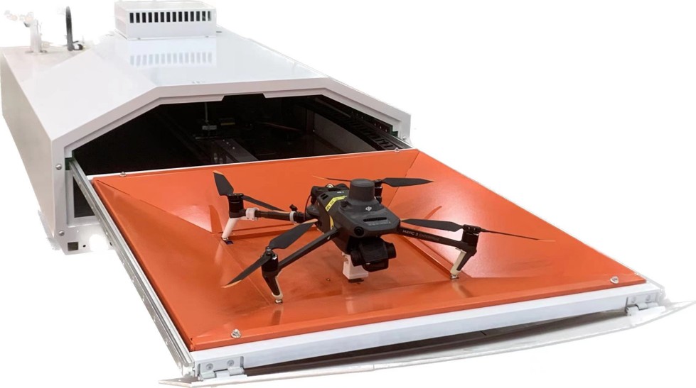
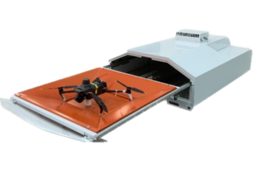
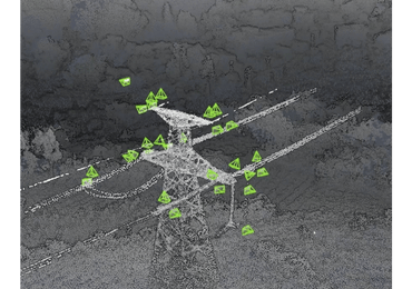
Key drivers include 50%+ cost savings vs manual inspections, regulatory approvals, and AIpowered analytics.
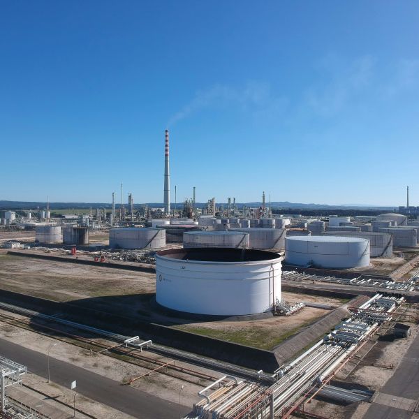
Top sectors: Oil & Gas ($4.8B) Energy ($3.2B) Construction ($2.1B)
North America leads (40% share), while AsiaPacific grows fastest.
(Sources: Grand View Research, BCG)