
RTK GNSS Receiver
High-Precision RTK GNSS Receiver for Surveying, Mapping, Agriculture & UAV Navigation – Fast Fix, Stable Signal, Real-Time Accuracy.
Description
An RTK GNSS receiver is a high-precision satellite navigation device. It uses Real-Time Kinematic technology to provide centimeter-level or even millimeter-level accuracy. This receiver processes signals from multiple global satellite systems such as GPS, BeiDou, GLONASS, and Galileo.RTK GNSS receivers are widely used in land surveying, precision agriculture, drone mapping, machine control, and autonomous navigation systems.

Centimeter-Level Accuracy
Perfect for tasks that require precise positioning, such as mapping, construction, and agriculture automation.
Real-Time Data Output
Provides real-time coordinate and motion tracking. Essential for dynamic environments such as drone flight or robot navigation.
High Reliability and Stability
Works in complex environments such as cities, mountains, and farms. Designed for field operations in all weather conditions.
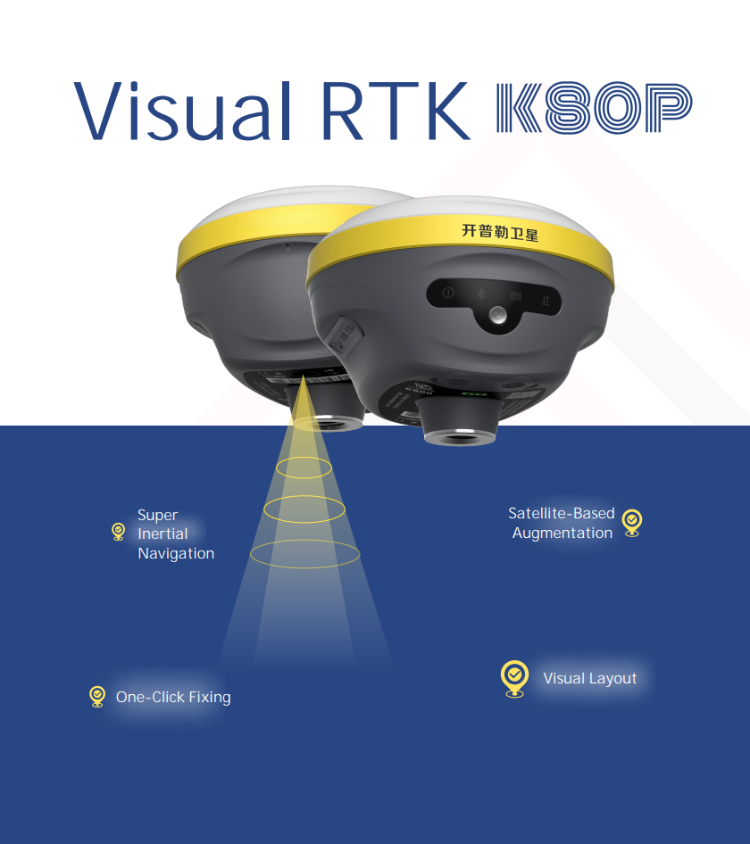
K80P
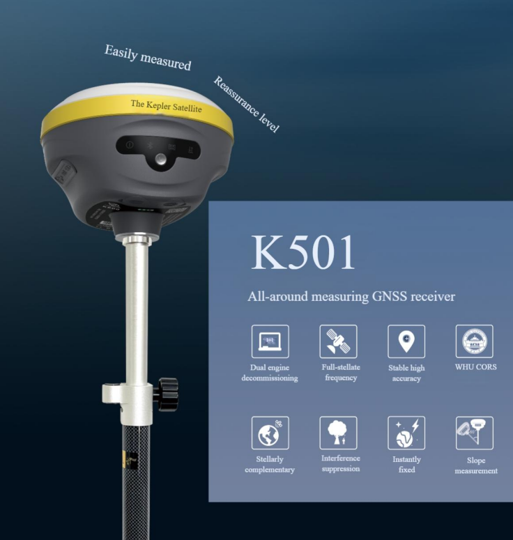
K501
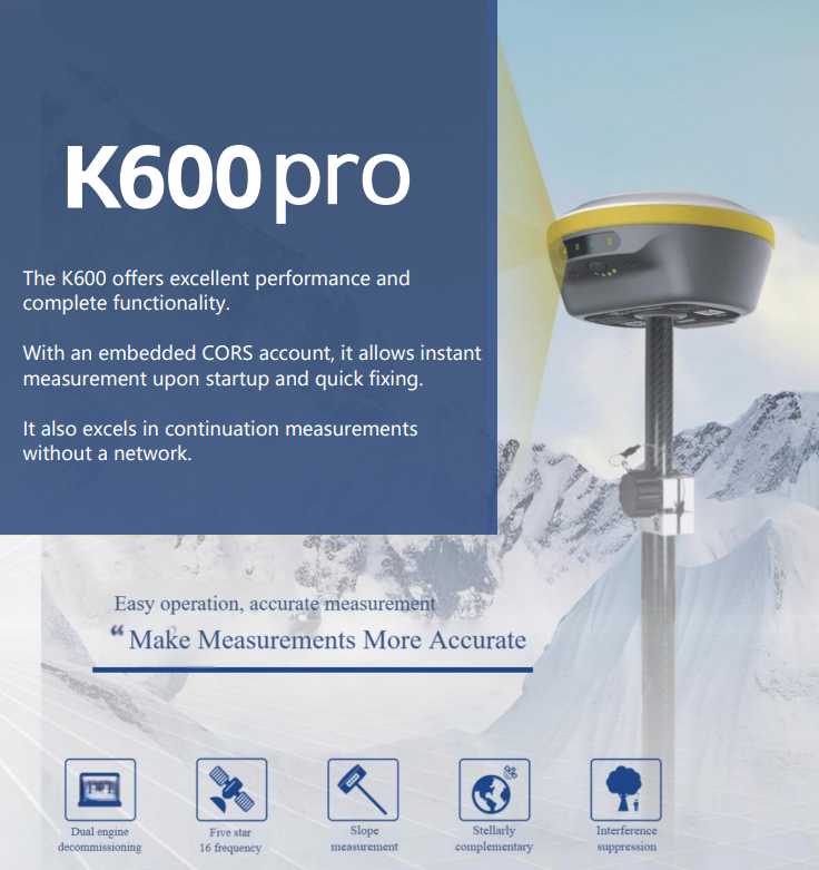
K600PRO
Highlights
-
Accurate and Fast
Provides fast initialization and stable positioning.
-
Flexible Configuration
vailable as base or rover units, modular or enclosed designs.
-
Low Power Consumption
Ideal for embedded systems and mobile platforms.
K80P Specification & Functions
| GNSS Performance | Channels | 1408 |
| Satellites Tracking |
GPS: L1C/A, L2P(Y), L2C, L5 GLONASS: L1, L2 BDS: B1I, B2I, B3I, BIC, B2a, B2b Galileo: E1, E5a, E5b, E6 QZSS: L1, L2, L5, L6 SBAS: L1 |
|
| Positioning Rate | 50 Hz | |
| Operation System | Linux | |
| Initialization Time | <5s (Typical value) | |
| Initialization Reliability | 0.9999 | |
| Static Horizontal Accuracy | ±(2.5mm + 0.5×10⁻⁶×D) | |
| Static Vertical Accuracy | ±(5mm + 0.5×10⁻⁶×D) | |
| RTK Horizontal Accuracy | ±(8mm + 1.0×10⁻⁶×D) | |
| RTK Vertical Accuracy | ±(15mm + 1.0×10⁻⁶×D) | |
| Tilt Angle | 0°~120° | |
| Data Output | Correction Data | RTCM2.X, RTCM3.X |
| GPS Data | NMEA 0183s RjK, Binary | |
| Function Configuration | Tilt Survey | Supported |
| PPK Survey | Supported | |
| Buzzer | Supported | |
| Voice | Supported | |
| NFC | Supported | |
| Size | 120×89 mm | |
| Feature | Weight | 0.65kg |
| Indicator Light | Satellite, Data, Power, Bluetooth | |
| Operating Temperature | -45℃ to +75℃ | |
| Storage Temperature | -55℃ to +85℃ | |
| Water/Dust Proof | IP67 | |
| Shock Resistance Grade | IK08 | |
| Shock | Survive a 2 m drop | |
| Static Data Format | TXT | |
| Static Data Recording | Data Storage | 32G |
| Battery Capacity | 7.4V, 7000mAh | |
| Electrical | Working Time | 20 hours (rover CORS mode) 7.5 hours (base station mode) |
| External Power | USB Type-C power, power bank supported | |
| I/O Port |
1 × USB Type-C port (power supply and charge) 1 × SMA ratio antenna port 1 × five-core LEMO port (9V–14V) |
|
| Communication | Wireless Communication Built-in Network |
Supports Bluetooth, 4G handheld devices, Wi-Fi, built-in 4G-LTE (B1/B3/B5/B7/B8/B20/B38/B40/B41), GPS/GLONASS/BDS (Compass)/Galileo/QZSS |
| Radio | Optional | |
| Radio Power | Transmit Power 2W | |
| Standard Internal Rx/Tx | 410–470 MHz | |
| Protocol | TRIMTALK 450S, TRIMMARK I, TRANSEOT, SOUTH | |
| Camera | Function |
5MP high-definition camera with a wide viewing angle, supporting real-life AR stakeout |
We’re Here to Help
Have a question about our products or services? Whether you’re looking for more information, need assistance with an order, or want to discuss potential cooperation, feel free to reach out.
Contact us via the form on the right, or email us directly at droneinspectioncn@gmail.com
We will contact you as soon as possible!