
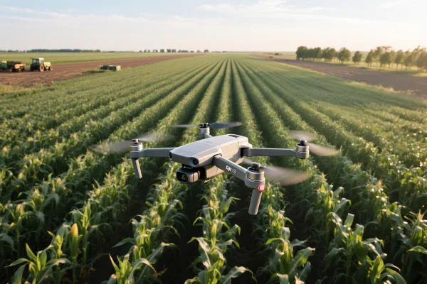
Agriculture drone Inspection
EFLY’s agriculture drone inspection solutions offer real-time crop health monitoring, pest detection, and precision mapping using multispectral and thermal imaging. Improve yield, reduce labor, and manage large farmlands efficiently with AI-powered aerial insights.
Description
Hunan EFly Aviation Technology Co., Ltd. provides a crop-soil-environment tri-monitoring system globally, integrating multispectral drones, edge computing AI, and blockchain traceability to deliver:
- High-precision Drone Monitoring – Multispectral imaging enables early detection of crop stress, pests, and nutrient deficiencies with centimeter-level accuracy.
- Real-time Decision Support – Edge AI processes data on-site, offering instant insights for precision irrigation, fertilization, and pesticide application.
- Transparent and Traceable Data – Blockchain-backed records ensure reliable, tamper-proof data for farm-to-table transparency and regulatory compliance.
Core Drone Monitoring Dimensions & Technical Specifications
| Target | Technology | Accuracy | Certification |
|---|---|---|---|
| Crop Health | Parrot 6-band multispectral drone | Chlorophyll error ±0.2μg/cm | CE/FCC/ISO 16119 |
| Soil Moisture | IoT probes (EC/pH/NPK sync) | 30cm depth real-time data | IP68 waterproof |
| Microclimate | Field weather station (CO₂/LUX sensors) | Temp. ±0.3°C | WMO-standard calibrated |
| Pests/Diseases | AI edge-computing terminal | 87-disease library, ≥89% recognition | Huawei Atlas chipset |
Key Advantages of EFLY's drone inspection & Monitoring service
Full-cycle management
Covers sowing-growth-harvest stages
Multi-source data fusion
Satellite (10m res) + drone (2cm res) synergy
Green compliance
Meets GlobalG.A.P & ChinaGAP standards
Mobile collaboration
Real-time reports via Software
Smart alerts
Disaster models based on 20-year historical data
Crop Digital Twin System
- 3D canopy modeling (NDVI/NDRE visualization)
- Photosynthetic efficiency heatmaps
- Yield prediction error <8%
Precision Plant Protection
- Pathogen spore traps (37 common pathogens)
- AI spray algorithms (25%+ chemical savings)
- Automated drone inspection route planning
Smart Irrigation Platform
- Soil tension monitoring (0-100kPa)
- ETc-adjusted evapotranspiration models
- Water-fertilizer integration control
Agri-Environment Network
- Greenhouse automation (temp/humidity/CO₂)
- Growing degree-day (GDD) alerts
- Extreme weather response protocols
Application Scenarios of Agri. drone inspection & monitroing service
- Field Crop Management: Targets wheat scab/rice leaf rollers via weekly drone scans (0.05 acres/sec) + satellite NDVI, reducing pesticide overuse by 23%.
- Greenhouse Automation: Light/CO₂/humidity sensors trigger controls, shortening strawberry cycles by 15% and boosting annual yield 30%.
- Orchard Optimization: AI harvesters + drone thermal imaging detect citrus greening/apple scab, with ≤0.5% sugar prediction error and 85% premium fruit rate.
- Pasture Drone Monitoring: 92%-accuracy grass coverage analysis + livestock health trackers improve grazing routes, raising forage use by 40% and milk yield 18%.
Contact Us
Ready to transform your agriculture inspections? Contact us today for smarter, safer, and more efficient drone monitoring solutions.
- WhatsApp:+86 138-0731-3486
- Email: droneinspectioncn@gmail.com
- Website: www.droneinspectioncn.com
We will contact you as soon as possible!