
Introduction
In the era of digital transformation, drones have become indispensable tools for industrial inspections across energy, infrastructure, agriculture, and construction. However, the hardware itself is only part of the story. What truly unlocks the potential of drone technology is the software that orchestrates operations, processes data, and transforms raw visuals into actionable insights.
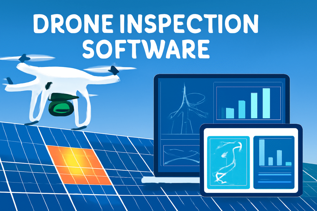
At the core of this technological leap lies drone inspection software, a solution designed to maximize efficiency, ensure safety, and deliver precise insights through automation and advanced analytics. For companies seeking to improve inspection accuracy while reducing costs, drone inspection software is no longer optional — it’s essential.
This blog will explore:
-
What drone inspection software is and how it works.
-
Key features such as mission planning, live monitoring, data visualization, and reporting.
-
Industry-specific applications.
-
How drone inspection software compares with traditional methods.
-
Why pairing software with solar-powered drone hubs creates a game-changing solution.
What is Drone Inspection Software?
Drone inspection software is a digital platform that integrates with drone hardware to manage, execute, and analyze inspection tasks. It provides an end-to-end solution, covering:
-
Mission planning: Designing flight paths and inspection routes.
-
Real-time monitoring: Overseeing drones during operations to ensure safety and compliance.
-
Data processing: Converting high-resolution imagery, LiDAR scans, or thermal data into structured datasets.
-
Visualization: Creating interactive 3D models, heatmaps, and dashboards.
-
Reporting: Automatically generating inspection reports for stakeholders.
By combining these capabilities, inspection software transforms drones from simple flying cameras into intelligent inspection systems.
👉 Explore more about drone-based solutions on our industrial inspection platform.
Key Features of Drone Inspection Software
1. Mission Planning
Mission planning ensures that drone flights follow precise routes, minimizing errors and maximizing coverage. Operators can predefine waypoints, altitudes, and camera angles, which eliminates guesswork.
Example applications include:
-
Mapping solar farms with consistent overlap for data stitching.
-
Inspecting wind turbine blades with close-up, repeatable flight paths.
-
Monitoring power lines across long linear routes.
Learn how drone inspection software supports repeatable and automated mission planning.
2. Real-Time Monitoring
During operations, the software provides live streaming of drone footage, telemetry data, and health indicators (battery life, GPS, altitude). This capability enhances:
-
Safety: Immediate detection of obstacles or hazards.
-
Efficiency: Multiple stakeholders can watch the live feed remotely.
-
Compliance: Records flight logs for regulatory requirements.
Our platform delivers robust inspection task management to ensure every mission runs smoothly.
3. Data Analytics
Raw images and sensor outputs mean little without analytics. Drone inspection software applies AI-powered algorithms to:
-
Detect cracks, corrosion, or hotspots.
-
Compare historical data for trend analysis.
-
Flag anomalies for further investigation.
This analytical backbone is crucial for industries such as energy, utilities, and manufacturing.
For advanced visualization, check our data visualization solutions that turn raw data into clear insights.
4. Data Visualization
One of the strongest advantages of drone inspection software is visualizing inspection data in intuitive formats. Dashboards, 3D models, and georeferenced maps help stakeholders interpret results faster.
Visualization use cases include:
-
3D models of construction sites to monitor progress.
-
Thermal heatmaps for solar panel defect detection.
-
Orthomosaics for agriculture yield predictions.
Visit our industrial inspection platform to explore real-time visualization tools.
5. Automated Reporting
Traditionally, inspection reports required days or even weeks. With drone software, reports can be automatically generated and shared within minutes. Reports typically include:
-
Annotated images.
-
Measurement data.
-
Risk assessment summaries.
This accelerates decision-making and ensures consistency across inspection teams.
Drone Inspection Software vs. Traditional Methods
To understand the value of drone inspection software, let’s compare it with traditional inspection approaches:
| Aspect | Traditional Inspections | Drone Inspection Software |
|---|---|---|
| Safety | Workers exposed to dangerous conditions (heights, power lines). | Remote inspections reduce human risk. |
| Cost | Requires scaffolding, cranes, or shutdowns. | Lower operational costs, minimal downtime. |
| Speed | Inspections may take days/weeks. | Data collected within hours. |
| Accuracy | Human error and limited visibility. | High-resolution imagery + AI analytics. |
| Data Storage | Paper logs and static photos. | Cloud-based, searchable databases. |
Clearly, adopting drone inspection software is a competitive advantage for forward-thinking organizations.
Industry Applications
Energy & Utilities
-
Inspecting power lines, substations, and wind turbines.
-
Identifying corrosion, wear, or overheating components.
Solar Farms
-
Detecting defective panels with thermal imaging.
-
Optimizing layouts through aerial mapping.
Construction & Infrastructure
-
Progress tracking via 3D mapping.
-
Detecting structural weaknesses early.
Oil & Gas
-
Monitoring pipelines in remote areas.
-
Ensuring compliance with environmental regulations.
For sector-specific solutions, explore our industrial inspection platform.
Combining Drone Software with Solar-Powered Drone Hubs
While drone inspection software provides digital intelligence, solar-powered drone hubs provide the physical backbone for sustainable and autonomous operations. Together, they form a closed-loop inspection ecosystem:
-
Drone hubs recharge drones using renewable energy.
-
Software schedules and deploys drones automatically.
-
Data is captured, processed, and reported without manual intervention.
This combination enables 24/7 autonomous inspections of large industrial sites — reducing costs, downtime, and human risk.
Future of Drone Inspection Software
Emerging trends shaping the future include:
-
AI-powered defect recognition with near-zero false positives.
-
Cloud collaboration for distributed inspection teams.
-
Edge computing for real-time analytics in the field.
-
Integration with IoT platforms for predictive maintenance.
As drones and AI evolve, companies using drone inspection software will stay ahead in efficiency and safety.
Conclusion
Drone inspection software is the linchpin of modern industrial inspections. By integrating mission planning, real-time monitoring, data visualization, and automated reporting, it empowers organizations to achieve safer, faster, and more accurate inspections.
When combined with solar-powered drone hubs, the solution evolves into a fully autonomous inspection ecosystem — capable of continuous operation with minimal human intervention.
For businesses seeking to stay competitive, investing in robust drone inspection solutions is not just a choice; it’s the future.
👉 Discover how our drone inspection software and inspection task management tools can transform your operations today.