
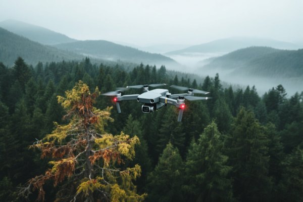
Forestry drone inspection
EFLY’s forestry drone inspection system enables fast, safe, and cost-effective forest monitoring, including tree health assessment, illegal logging detection, and wildfire risk analysis. Our drones deliver high-resolution data from hard-to-reach forest areas.
Description
Hunan EFly Aviation’s self-developed drone hub system is a fully automated solution for large-scale forest and farmland management. Integrating hub-to-hub networking, multispectral remote sensing, and AI-powered fire drone detection, it enables:
- 100 km² coverage per hub
- ≤3-minute wildfire response time (thermal imaging accuracy ±0.5°C)
- 400% increase in pest and disease drone detection (vs. manual inspection)
- <5% error in forest carbon sink measurement (compliant with VCS carbon credit standards)
Core Drone Monitoring Dimensions & Technical Specifications
| Aspect | Traditional Patrol | Drone-Based Inspection |
|---|---|---|
| Efficiency | Covers less than 10 km² per day; limited by terrain and weather. | Up to 100,000 hectares covered in 48 hours with automated flights. |
| Data Timeliness | Manual recording causes delays; not suitable for real-time decision-making. | Real-time data transmission supports rapid analysis and response. |
| Safety | High risk in steep or dense areas; frequent field-related accidents. | Remote operation minimizes human exposure in hazardous zones. |
| Cost | Labor and maintenance exceed 30% of forestry management budgets. | Lower operational cost with automation and minimal on-site personnel. |
| Environmental Impact | Patrols may disturb wildlife and fragile ecosystems. | Electric motors (<45 dB) ensure minimal ecological disruption. |
| Diagnostic Capability | Dependent on human observation; lacks analytic consistency. | Integrated with 12 forestry-specific AI models for smart diagnostics. |
| Emergency Response | Manual deployment of fire suppression or rescue tools. | Supports aerial release of fire retardants and locator beacons. |
| Terrain Adaptability | Limited access to mountainous, wetland, or remote areas. | Effectively operates in complex and high-risk terrain types. |
3 Technical Breakthroughs of Efly's Drone Hub System
Extreme-environment operation
1. IP56-rated, functions at -20°C to 60°C
2. Solar-powered with 15-day rainy-day backup
Precision navigation
1. RTK cm-level positioning + AI obstacle avoidance (works in >80% canopy density)
2. ≤0.5m route deviation; dynamic path planning for fires
Secure data relay
1. 5G/private network dual-channel transmission (works offline)
2. Blockchain-encrypted storage for audit compliance
The Functional of Efly's drone inspection and monitoring system
| Module | Technology | Application |
|---|---|---|
| Multi-source data fusion | LiDAR + multispectral imaging | Timber volume calculation, carbon accounting |
| AI disease detection | Deep learning (≥98% accuracy) | Pine wilt disease/fall webworm early warning |
| Fire simulation system | Digital twin + weather integration | Fire spread prediction, resource allocation |
| Compliance audit | Blockchain + geofencing | Logging permits, ecological redline monitoring |
Workflow
Task dispatch
- Set zones/frequency via web/APP.
Auto-execution
- Drones launch from hubs, hover for detailed scans.
AI analysis
- Generates disease heatmaps/fire risk reports in 30s.
Decision-making
- Data syncs to command centers for emergency response.
Contact Us
Ready to transform your forestry drone inspections? Contact us today for smarter, safer, and more efficient drone monitoring solutions.
- WhatsApp:+86 138-0731-3486
- Email: droneinspectioncn@gmail.com
- Website: www.droneinspectioncn.com
We will contact you as soon as possible!