
Software & Analytics
EFLY Aviation specializes in the development and deployment of drone docking stations and intelligent inspection solutions.
Description
EFLY possesses full-stack development capabilities across embedded systems, backend servers, and frontend platforms for drone inspection & monitoring industry. Our core technologies include data analytics, 3D reconstruction, AI-based object recognition, flight control system development, and intelligent drone dock management systems—supporting the end-to-end operation of complex autonomous drone platforms.
Highlights
-
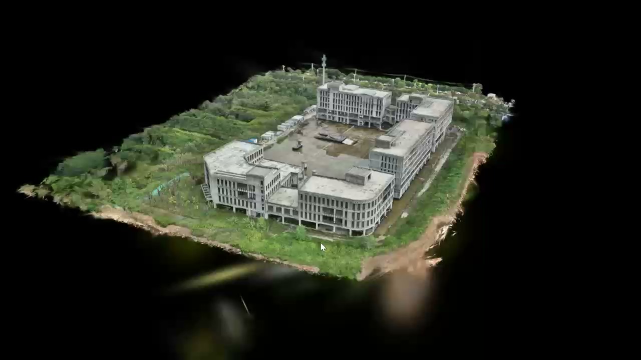
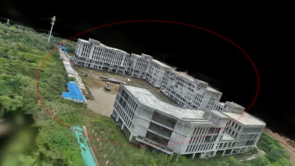
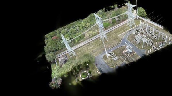
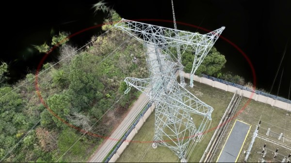
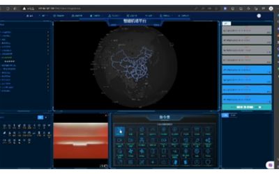
1. Immersive 3D GIS Visualization and Analysis
Delivering smooth, high-volume 3D mapping and spatial analysis for smarter, faster decisions.
-
2.Smart 3D Reconstruction with AI
Transforming video and photo data into accurate 3D models using advanced SFM and AI technologies.
-
3. High-Efficiency AI Image Recognition
Fast and accurate image recognition that detects, analyzes, and responds in real-time—built for drone inspection.
-
4. Intelligent Flight Control System
Self-developed drone flight controller built on leading open-source frameworks with AI integration.
-
5. Automated Drone Dock Management
IoT-based drone station control technology for fully autonomous operations and real-time drone monitoring.
-
6. Full-Stack Platform Development
Proven experience in building complete systems—from embedded software to cloud backend and user interface. We design and deliver complete, battle-tested drone inspection solutions for more than 10years.
Immersive 3D GIS Visualization and Analysis
- Power Line Tree Height Analysis Software for Drone Inspection.
- Power Line Tree Obstruction Area Analysis Software
- Automated Power Line Point Cloud Classification Software for Drone Inspection
- Automated Tree Obstruction Analysis Software for Distribution Networks
- Real-Time Safety Analysis Platform for Distribution Network with Beidou-Enabled Helmet Positioning
- Grid-Based Environmental Air Quality Analysis


Smart 3D Reconstruction with AI for Drone Inspection
- High-Precision Urban 3D Modeling for Smart City Development
- Accurate Corridor Modeling for Power Line Planning and Maintenance
- Advanced Applications for Power Infrastructure Construction and Management
High-Efficiency AI Image Recognition
- Advanced Video and Visual Tracking for Dynamic Target Monitoring
- AI-Guided Precision Landing for Drones
- Automated Power Line Defect Detection Using AI Vision
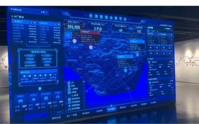
Automated Drone Dock Management
- Integrated Platform for Power Inspection and Control
- Smart Management Platform for Automated Drone Docking Stations
- Digital Water Resource Monitoring and Management Platform
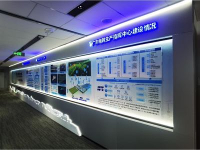
Full-Stack Platform Development
- Complete Software Development Partner for the Operations Command Center of Guangdong Power Grid’s UAV Inspection Management Center.
We’re Here to Help
Have a question about our products or services? Whether you’re looking for more information, need assistance with an order, or want to discuss potential cooperation, feel free to reach out.
Contact us via the form on the right, or email us directly at droneinspectioncn@gmail.com
We will contact you as soon as possible!