
Surveying & Mapping Service
Fast, Accurate, and Scalable Mapping Solutions Powered by Efly’s Drone Inspection and Monitoring Tech.
Description
Drone Surveying: The Digital Backbone of Drone Intelligent Inspections
— Redefining Standards with Efly’s Drone Hub & Custom Software.
Drone inspections are rapidly replacing manual methods, powered by drone surveying—the “digital backbone” of this transformation. As the core of spatial data collection, drone surveying provides precise geospatial frameworks while integrating with EFLYS Drone Hub and tailored software to automate the “capture-to-decision” workflow.
Through precision surveying and industry-tailored algorithms, drone inspections are significantly enhanced across the power energy, agriculture & forestry, and construction & infrastructure sectors etc.
Core Advantages Efly's drone monitoring and inspection Service.
Fully Automated Patrols
Enables scheduled, autonomous inspection with auto-charge and data upload.
Wide Coverage
Efficiently drone monitors long pipelines across remote or complex terrains.
Rapid Emergency Response
Quick deployment for leak detection or unauthorized activity.
Intelligent Data Analysis
AI-powered analytics for anomaly drone detection and predictive maintenance.
Application Scenarios of drone monitoring survey & mapping
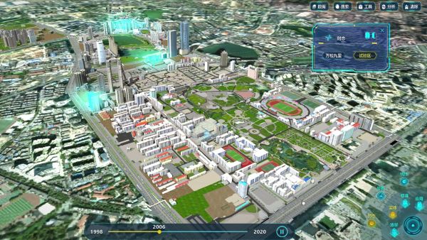
1. Land Surveying and Urban Planning
- Topographic Mapping: Rapid generation of 1:500 to 1:2000 scale topographic maps for land ownership confirmation and road planning.
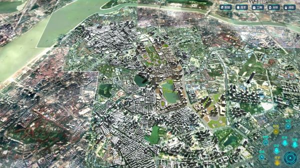
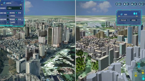
- 3D City Modeling: Centimeter-accurate digital twin cities built via oblique photo grammetry, supporting smart traffic systems and emergency evacuation simulations.
- Case Study: In planning a new district in Shenzhen, drones completed 20 sq.km of terrain mapping in 3 days, achieving a 10-fold efficiency gain over traditional methods.
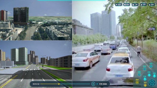
2. Construction Engineering & Monitoring
- Earthwork Volume Calculation: Multi-phase surveys ensure precise excavation/fill calculations with <3% error margin.
- Progress Tracking: Regular aerial surveys align with BIM models to monitor construction deviations and delays in real time.
- Case: During the HongKong-Zhuhai-Macao Bridge project, drone LiDAR detected millimeter-level pier settlement, ensuring structural safety.
3. Cultural Heritage Preservation
- Digitalization of Ancient Structures: Oblique photo grammetry captures precise architectural details for restoration planning.
- Archaeological Exploration: Multispectral imaging reveals buried relics underground, minimizing damage from manual excavation.
- Case: The Mogao Caves in Dunhuang used drone mapping to create a high-precision digital archive, enabling permanent preservation.
Drone survey advantages
-
1. Unmatched Efficiency: From Weeks to Hours
Drone Hub-coordinated missions cover 10-50 km² per flight (sensor-dependent), 10-50x faster than manual surveys.
Example: Traditional 1 km² mapping requires 3 workers over 5 days; drones deliver results in 2 hours. -
2. Centimeter Precision: Engineering-Grade Accuracy
Drone inspection systems with RTK achieve 2-5 cm horizontal / 3-8 cm vertical accuracy, meeting strict project standards.
-
3. Cost Revolution: 70% Savings
Eliminate scaffolding, climbing crews, and manual risks. Drone Hub deployments cut costs to <30% of traditional methods.
-
4. Extreme Adaptability: No Terrain Left Behind
Drone inspection fleets operate in deserts, swamps, and mountains (-20°C to 50°C), overcoming human accessibility limits.
-
5. Multisensor Intelligence: Data Fusion Redefined
Drone Hub integrates visible-light, thermal, LiDAR, and RGB data for layered analysis (e.g., “imagery + heatmaps + point clouds”).
-
6. Real-Time Iteration: Dynamic Decision Support
Enable repeatable drone monitoring cycles (e.g., weekly mine deformation analysis) via Drone Hub’s automated data pipelines, accelerating responsive management.

Contact Us
Ready to transform your surveying & mapping service? Contact us today for smarter, safer, and more efficient drone monitoring solutions.
- WhatsApp:+86 183-9080-4731
- Email: droneinspectioncn@gmail.com
- www.droneinspectioncn.com
We will contact you as soon as possible!